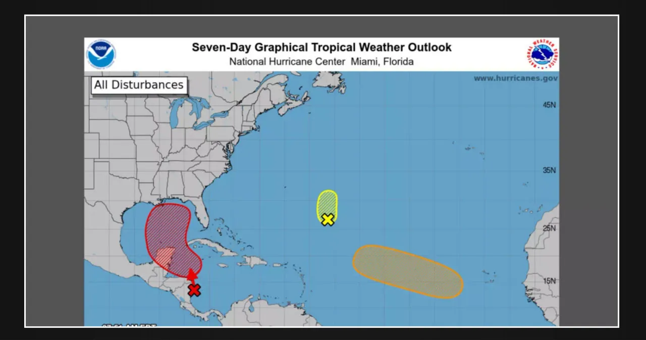
We have been monitoring the conditions for several days in anticipation of a potential tropical development. A low-pressure area is expected to form over the western Caribbean Sea within the next day.
Forecasters are currently suggesting that there is a high probability of the formation of a tropical storm or hurricane. The probability of formation through seven days is currently at a high level of 70%.
The Weather Channel reported that “interests along the entire U.S. Gulf Coast should continue to monitor the situation closely and stay updated on how the forecast unfolds in the days ahead.”
The National Hurricane Center. stated that the environmental conditions are conducive to the incremental development of this system over the next few days. “A tropical depression is likely to form while the system moves slowly northward across the northwestern Caribbean Sea and the Gulf of Mexico through the end of the week.”
“The Florida Panhandle has the highest landfall probabilities,” according to James Spann, Chief Meteorologist at Townsquare Media Tuscaloosa and ABC 33/40. However, it is important to note that ensemble members have the potential to make landfall in a wide range of locations, including Fort Myers and the Alabama/Mississippi border. The majority of members are located between Pensacola Beach and Apalachicola.
The Weather Channel stated, “It is certainly feasible.” “Oceanic heat content is one favorable ingredient for intensification, and the map below shows there is plenty of deep, warm water in the northwest Caribbean and parts of the Gulf of Mexico.”


Leave a Reply