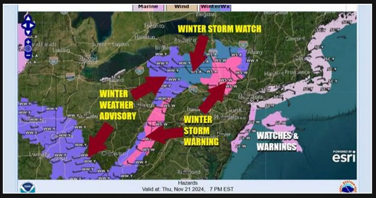
Today and Friday will be quite busy weather-wise. Winter Storm Warnings have been issued for Northeastern Pennsylvania and the Catskills, while Winter Storm Watches are in effect for surrounding areas. Additionally, Winter Storm Warnings have been posted for the Appalachians, spanning from Southwest Pennsylvania to West Virginia. Elevations above 1000 feet could see up to a foot of snowfall.
Across Eastern Pennsylvania to Southern New England, people are rejoicing over the much-needed rainfall after three months of dry weather. Overnight, rain and thunderstorms have moved through the region. The radar shows that the first round of rain is tapering off, but there is still more to come. A low-pressure system is forming east of New Jersey, and it will combine with an upper-air storm. This system will move in a counterclockwise direction from today until Friday, looping into Upstate NY and then moving southward into Pennsylvania on Friday before moving offshore Friday night.
As the initial wave of rain moves northeast, the trailing edge slows down and lingers for a while, resulting in an extended period of rain for Northern New Jersey and areas further north and east today. Subsequently, intermittent showers are expected overnight and throughout Friday. In elevated areas above 750 to 1000 feet, the rain will gradually transition to wet snow later tonight and persist into Friday. Temperatures will gradually decline through the 40s, particularly in inland regions where snow may become a concern, with lows dropping to the low and mid-30s, especially during periods of intense snowfall.
After this is all said and done, most of the area will have received a significant amount of rainfall, ranging from one and a half to three inches. While it may not completely end the drought, it is definitely a step in the right direction. Once the storm passes, we can expect better weather conditions over the weekend.


Leave a Reply