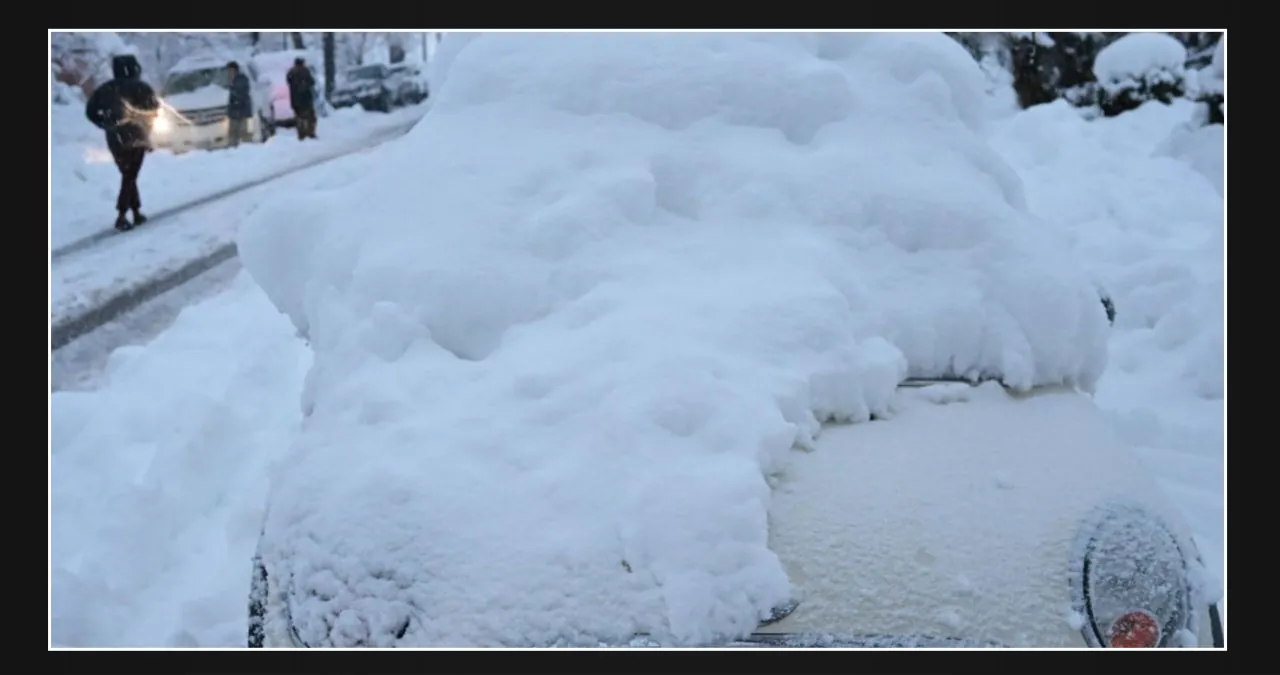
A major winter storm system is sweeping over sections of the United States, forcing the National Weather Service (NWS) to issue winter storm warnings in Alaska, New Mexico, Colorado, Wyoming, and Montana.
Forecasters predict heavy snowfall, ice conditions, and high winds, which could make travel problematic and impact the towns in these states. Local authorities have warned of potential travel delays and urged locals to use extra caution on the roads.
Temperatures in Alaska have already plummeted due to the storm system, and forecasts indicate significant snowfall in both the interior and coastal regions. We expect blowing snow and severe winds, with a total snow accumulation of up to one inch and easterly gusts reaching up to 60 mph. The warning remains in effect for the Eastern Beaufort Sea Coast until midnight AKST Wednesday.
Forecasts predict strong gusts and blowing snow throughout Alaska’s Western Arctic Coast, including Point Lay. Areas of blowing snow may drastically decrease visibility. At times, easterly winds could gust as high as 50 mph, reducing visibility to one quarter mile or less. The alert is in effect until 3 p.m. AKST Wednesday.
According to the National Weather Service, “high winds along coastal regions could cause blowing snow and reduced visibility, making travel treacherous.”
We also expect the storm to bring heavy snow and strong winds to Colorado, Wyoming, and Montana in the lower 48 states.
The weather warning affects several sections of Colorado. Castle Rock has extended its winter storm warning until 11 p.m. MST Wednesday, following a warning for Elbert/Central and East Douglas counties above 6,000 feet, including the cities of Larkspur, Kiowa, Castle Rock, Fondis, and Elbert until Tuesday evening.
Forecasters predict heavy snow, with additional accumulations of 7 to 14 inches and winds of up to 40 mph.
The NWS warns that “snow-covered roads will make travel hazardous, with the possibility of extremely difficult or impossible travel.” The hazardous circumstances may impact the Wednesday morning and evening commutes.
North Lincoln County-Washington County, which includes the cities of Last Chance, Otis, Matheson, Agate, Hugo, Cope, Limon, and Akron, has also received a weather warning.
Forecasters predict heavy snowfall, with further accumulations ranging from 8 to 16 inches, and locally higher totals likely. Winds will gust as high as 40 mph. The warning is in effect until 5 a.m. MST Thursday and states that travel may be “very difficult to impossible.”
Forecasters predict additional snow accumulations of up to 2 inches in Southern El Paso County, with wind gusts reaching 50 mph. The weather warning will be in effect until 11 a.m. MST Wednesday. We urge motorists to “plan for slick and hazardous road conditions.”
We expect additional snow accumulations in the Southern Sangre de Cristo Mountains ranging from 6 to 16 inches, with a likelihood of 20 inches, and gusts reaching up to 35 mph. The winter storm warning is in effect until 11 p.m. MST Wednesday.
Northern El Paso should anticipate 3 to 5 inches of snow, with winds reaching up to 50 mph.
Western and Central Fremont County residents below 8,500 feet should expect severe snowfall, with additional snow accumulations ranging from 2 to 6 inches and total snow accumulations ranging from 6 to 12 inches.
The winter storm warning for both remains in effect until 5 p.m. MST Wednesday.
The NWS warns that travel could be extremely difficult; “Areas of blowing snow may considerably decrease visibility.” The hazardous conditions will affect Wednesday morning and evening travel. Strong winds could knock down tree branches.”
Colorado’s Northern Sangre de Cristo Mountains, Wet Mountains, and Wet Mountain Valley expect heavy snow, with additional accumulations ranging from 5 to 10 inches and winds up to 40 mph. The storm warning is in force until 11 p.m. MST on Wednesday.
Byers, Colorado, may receive significant snowfall, with further accumulations of 7 to 14 inches and winds reaching up to 35 mph. The storm warning remains in effect until 5 a.m. MST Thursday.
Cheyenne, Kit Carson, and Yuma counties will have heavy snowfall, with additional accumulations ranging from 3 to 12 inches. The NWS warns that highways, particularly bridges and overpasses, will likely become slick and dangerous. Travel could be extremely difficult or impossible.
Winds may gust to 30–40 mph, particularly Wednesday morning. “Blowing snow may be possible at times; be alert for sudden reductions in visibility,” cautions the National Weather Service. The weather warning is in force until 5 a.m. MST Thursday.
Forecasters predict additional snow accumulations of 1 to 3 inches in Montana’s Pryor/Northern Bighorn Mountains, with gusts of up to 35 mph causing blowing and drifting snow.
“Heavy snow accumulation will have an impact on recreational activities in the high country.” Travel on US-14 may be extremely difficult,” the NWS warned. The weather warning will be in effect until 11 a.m. MST Wednesday.
We forecast heavy snow in Wyoming, with further accumulations ranging from 1 to 3 inches. Locally larger amounts are likely, and gusts up to 35 mph may occur on the west slopes of the Bighorn Mountains, particularly in northern Bighorn County. The weather warning will be in effect until 11 a.m. MST Wednesday. The National Weather Service warns that travel along Granite Pass and Powder River Pass may be extremely difficult.
Parts of New Mexico are also under winter storm warnings, with strong winds predicted. Forecasters predict heavy snowfall in the Sangre de Cristo Mountains, Upper Rio Grande Valley, Johnson and Bartlett Mesas, and Raton Pass, with three-day total snow accumulations ranging from 12 to 24 inches, with the exception of 35 inches or more at mountaintops and 6 to 12 inches around Taos. Winds could gust as high as 35 mph. The warning is in effect until 5 p.m. MST Friday.
The NWS warns of numerous road closures and discourages travel, stating: “Areas of blowing snow may limit visibility to near zero at times, creating dangerous travel conditions.”
We forecast heavy snow in Eastern San Miguel County, Far Northeast Highlands, Harding County, Northeast Highlands, and Union County, with total accumulations ranging from 6 to 12 inches; however, quantities in the western regions of these locations might reach two feet. We anticipate gusts of wind reaching up to 35 mph. The storm warning is valid from 5 p.m. Wednesday until 5 p.m. MST Friday.
Forecasters predict heavy snowfall in the Tusas Mountains, including Chama, with total accumulations ranging from 5 to 10 inches, and up to 20 inches on the peaks. The warning is in effect until 5 p.m. MST Friday.
Total snow accumulations in the Jemez Mountains, Northwest Highlands, Southwest Mountains, and West Central Mountains will range from 6 to 12 inches, with up to 24 inches over 8500 feet.
The NWS warned that traffic could be “very difficult” and encouraged care in hilly places, particularly along I-40 between Grants and Gallup. Tire chains may be required when traveling across mountain passes.”
We also forecast heavy snow in the San Agustin Plains and Adjacent Lowlands, Espanola Valley, and West Central Highlands, with total snow accumulations ranging from 3 to 6 inches, except above 7,500 feet, where it might reach one foot. The warnings are in effect from 5 p.m. Wednesday to 11 a.m. MST Friday.
The Sandia and Manzano Mountain areas are also under a storm warning until Friday. Forecasters predict heavy snow accumulations over three days, ranging from 6 to 12 inches, and potentially up to 24 inches over 8,500 feet. Edgewood, Glorieta Mesa (including Glorieta Pass), Santa Fe Metro Area, Estancia Valley, Central Highlands, South Central Highlands, South Central Mountains, Guadalupe County, and Eastern Lincoln County are among the places affected.
The warning is in effect from 5 p.m. Wednesday to 11 a.m. MST Friday. The NWS warned that travel could be extremely difficult or impossible, particularly along areas of I-40 east of Albuquerque and I-25 from Santa Fe to Las Vegas. Some roads may be closed. Significant travel delays are possible. The hazardous conditions may impact the Wednesday evening and Thursday morning commutes.
Forecasters predict heavy snowfall in the Middle Rio Grande Valley, including the Albuquerque Metro Area, with total accumulations of 1 to 3 inches. Above 6,000 feet, winds can gust up to 50 mph, resulting in up to 6 inches. The winter weather warning is in effect from 8 p.m. Wednesday to 11 a.m. MST Friday.
The NWS cautioned that travel will be difficult and gave the following advice: “Tire traction will be reduced.” Increase the distance between your car and the one in front of you. Additional advice was provided: “Wednesday night, a strong east canyon wind with gusts up to 50 mph may generate near-whiteout conditions below Tijeras Canyon.” The most snow in the Albuquerque Metro region will fall along and east of Tramway, as well as higher up on the west mesa.
The NWS advised all motorists to defer their journey if possible. If travel is absolutely required, proceed with extreme caution and be prepared for rapid changes in visibility. Allow plenty of space between you and the driver in front of you, and give yourself additional time to get to your destination.
“Avoid rapid braking or acceleration, and exercise extra caution on hills or when turning. Make sure your car has undergone winterization and is in optimal working condition. If you must go, keep an extra flashlight, food, and water in your vehicle in the event of an emergency. Get the latest road conditions in your state by calling 511.


Leave a Reply