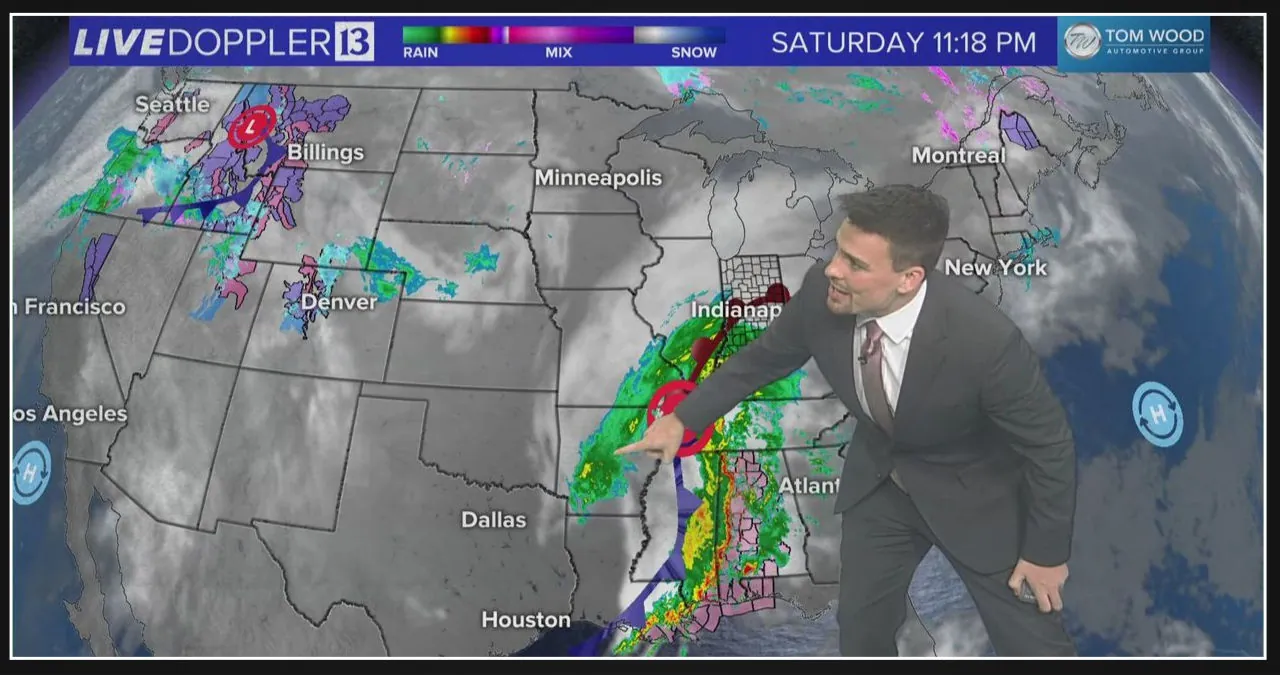
Afternoon wind gusts could reach speeds of up to 50 MPH across a significant portion of central and northern Indiana. There is a chance of a few power outages occurring as a result.
Indiana is bracing itself for a significant amount of rainfall, with precipitation expected to begin at 10 p.m. on Saturday and continue until 10 p.m. on Sunday. Some areas may see up to 2.5″ of rain during this time.
Main things to know:
This Article Includes [hide]
-
- No severe weather expected, although there may be a few rumbles of thunder in eastern Indiana.
- Expect rain for the majority of Sunday. It will start wet and end wet.
- A few dry spells are possible across central and eastern Indiana in the afternoon.
- Most Hoosiers will pick up 1 to 1.5 inches of rain by Sunday 10 p.m.
- A few counties, especially west of Indianapolis, may pick upwards of 2.5 inches.
Timing the rain
Most of the rain in the state is expected to occur between 10 p.m. on Saturday and 10 p.m. on Sunday. However, the intensity and coverage of the rain will vary throughout the day on Sunday. Let’s take a closer look at the next 24 hours.
Saturday Night
Rain will begin to fall in southern Indiana after dark on Saturday.
The bands of precipitation are expected to move northward and are predicted to reach the Indianapolis area at around 10-11 p.m.
Throughout the night, the rain will primarily consist of light showers. The temperatures will remain in the 50s, accompanied by strong east-southeast winds blowing at a speed of 10-15 MPH.
Sunday Morning
The heaviest rainfall is expected to occur between 4 a.m. and 11 a.m. throughout central and northern Indiana.
On the north side of the low pressure system, the atmosphere will experience compression, resulting in a greater amount of rainfall. Additionally, the jet stream above will enhance the efficiency of rain production.
Don’t forget to grab your rain jacket or umbrella as you head out on Sunday morning for breakfast or worship services, as the forecast predicts a very rainy start.
Sunday afternoon
Expect lighter rain during the afternoon as the low pressure moves overhead, especially in eastern Indiana, following heavier rainfall in the morning.
Scattered downpours could still occur on the south side of the low in far southern Indiana, as the warm air lingers near the Ohio River.
The afternoon will bring intermittent mist and drizzle to much of the state.
During the afternoon, temperatures will rapidly decrease as northwest winds begin to take over, bringing gusts of up to 30 MPH.
Sunday evening
As the day comes to a close in Indiana, we can expect the emergence of more widespread rainfall and heavy downpours.
The rain will be cold and accompanied by a refreshing breeze.
The rain will gradually stop in southern Indiana as the storm’s center moves towards Lake Erie throughout the evening.
Sunday night
The rain will gradually taper off during the night as the gentle northwest winds bring temperatures down to the 30s and 40s.
Michigan and far northern Indiana could potentially experience a brief wintry mix.
How much rain to expect Sunday
The majority of the state will receive at least an inch of rain, with slightly less expected in the far northwestern region near Lake County.
Most Hoosiers are expected to receive around 1.5 inches of snow, although certain areas to the west of Indianapolis may experience accumulations closer to 2 or 2.5 inches.
Individual downpours within the rain bands can cause slight variations in your expected rainfall total. So, it’s not uncommon for the actual amount to be slightly more or less than what was initially forecasted.
Looking ahead
Monday will bring a temporary respite from the inclement weather, as the skies will be partly cloudy with temperatures in the 50s. However, this calm won’t last long, as more weather systems are expected to arrive in time for the New Year. Brace yourself for near-zero wind chills by the following weekend.
Cold air is making a strong comeback.


Leave a Reply